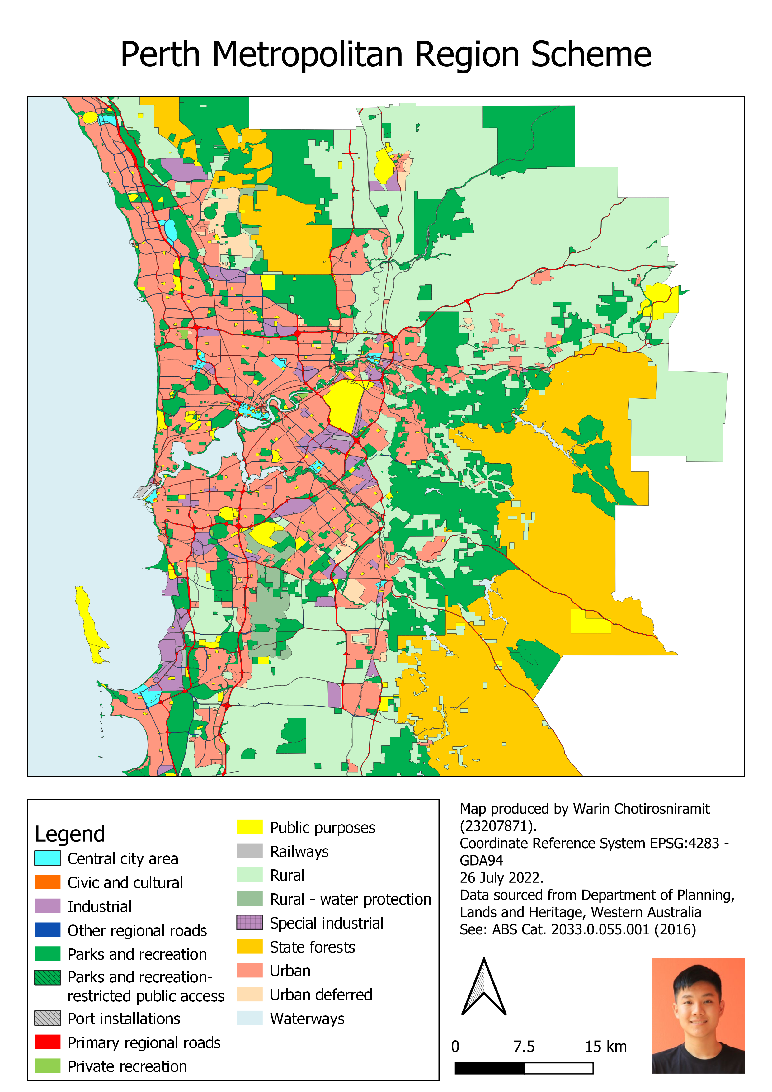
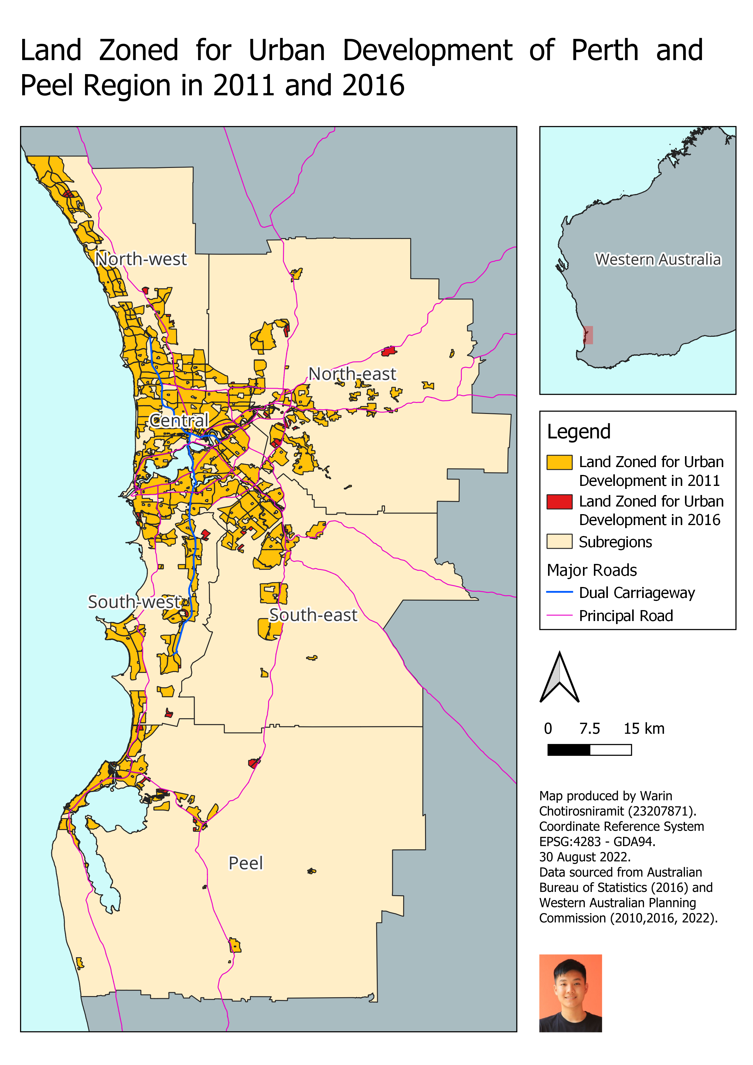
Land Zoned for Urban Development in Perth and Peel Subregions
Summary: Urban sprawl can lead to a range of problems, such as traffic congestion and pollution. This report, which is the first assignment of GEOG2201 (Geographic Infromation System), aims to numerically and spatially identify land zoned for urban development in 2011 and 2016 using QGIS. This allowed us to calculate the annual rate of urbanisation from 2011 to 2016.