Relationship between land surface temperature and land cover in major Australian cities
Summary:
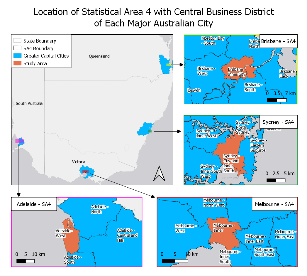
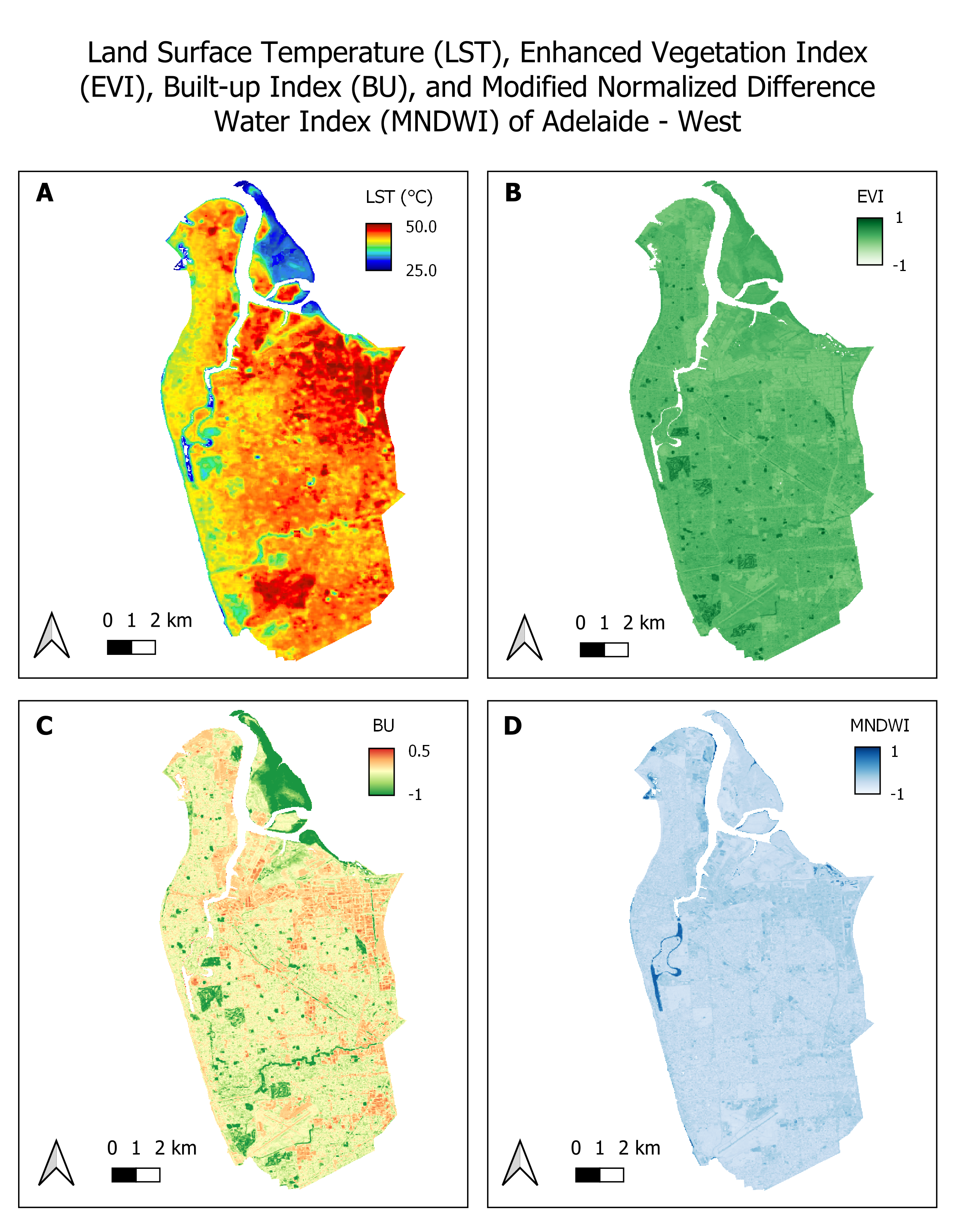
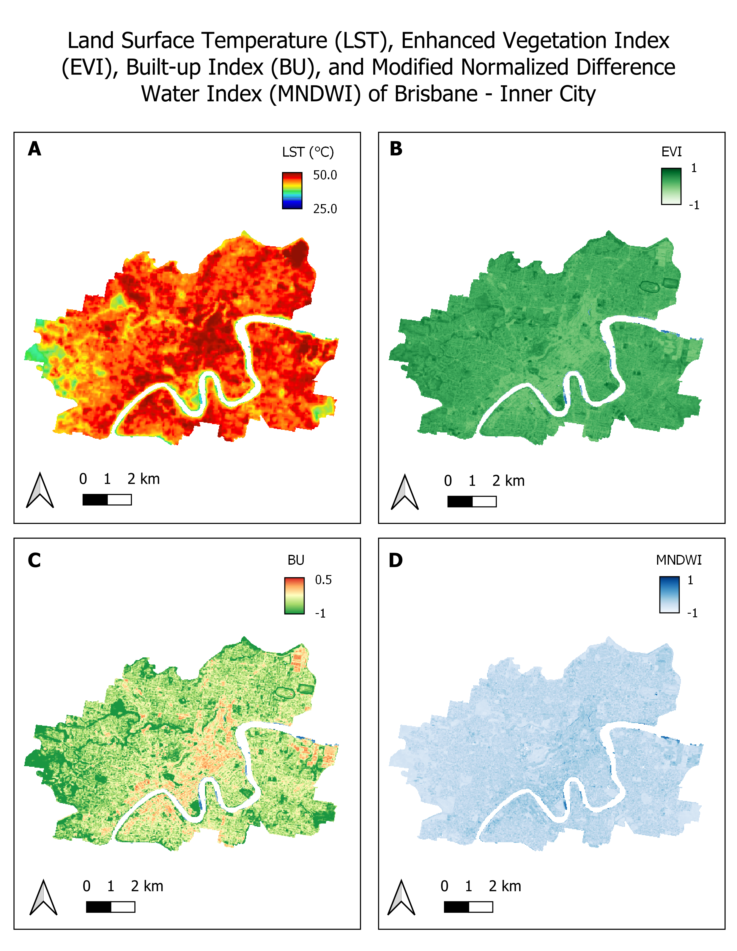
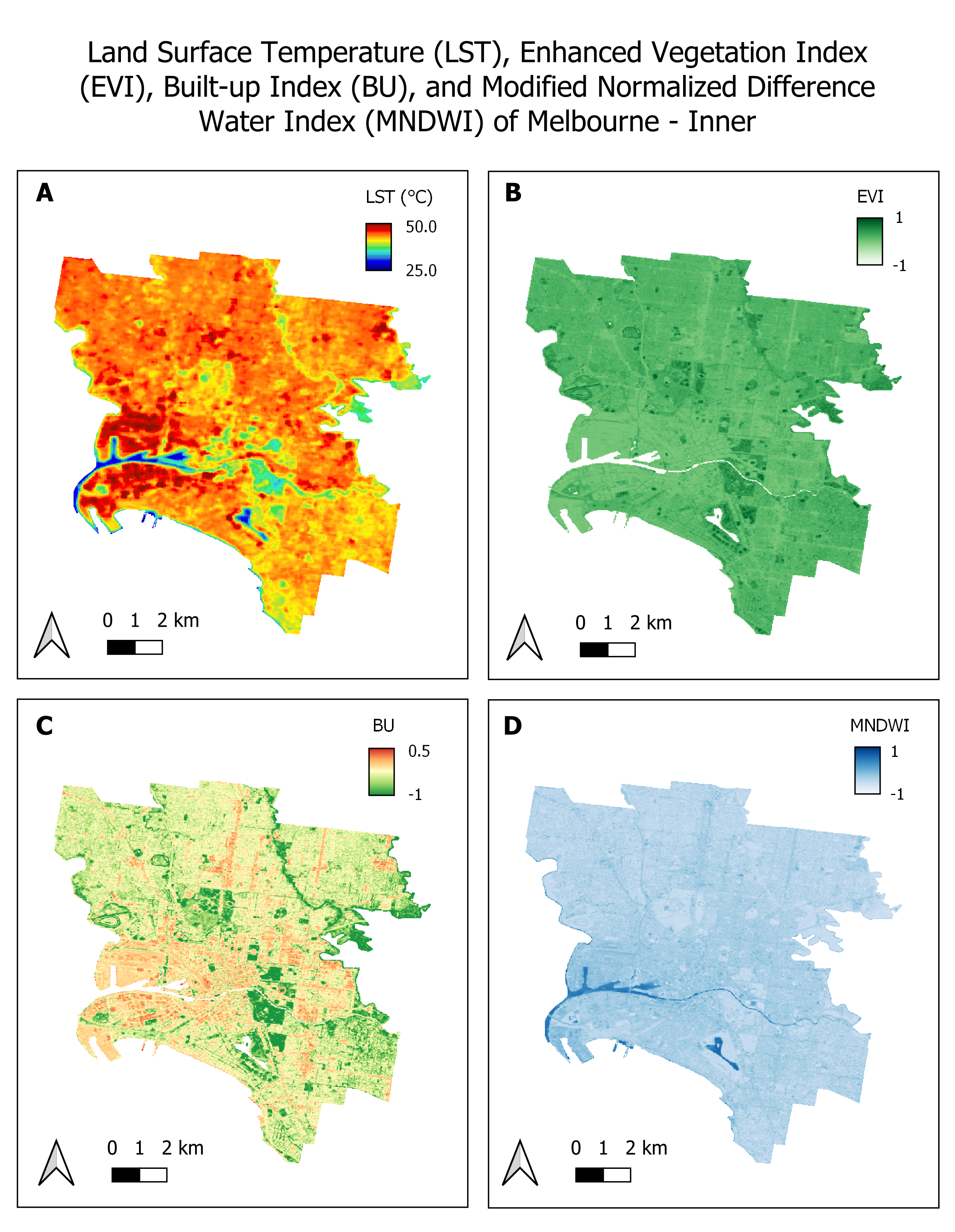
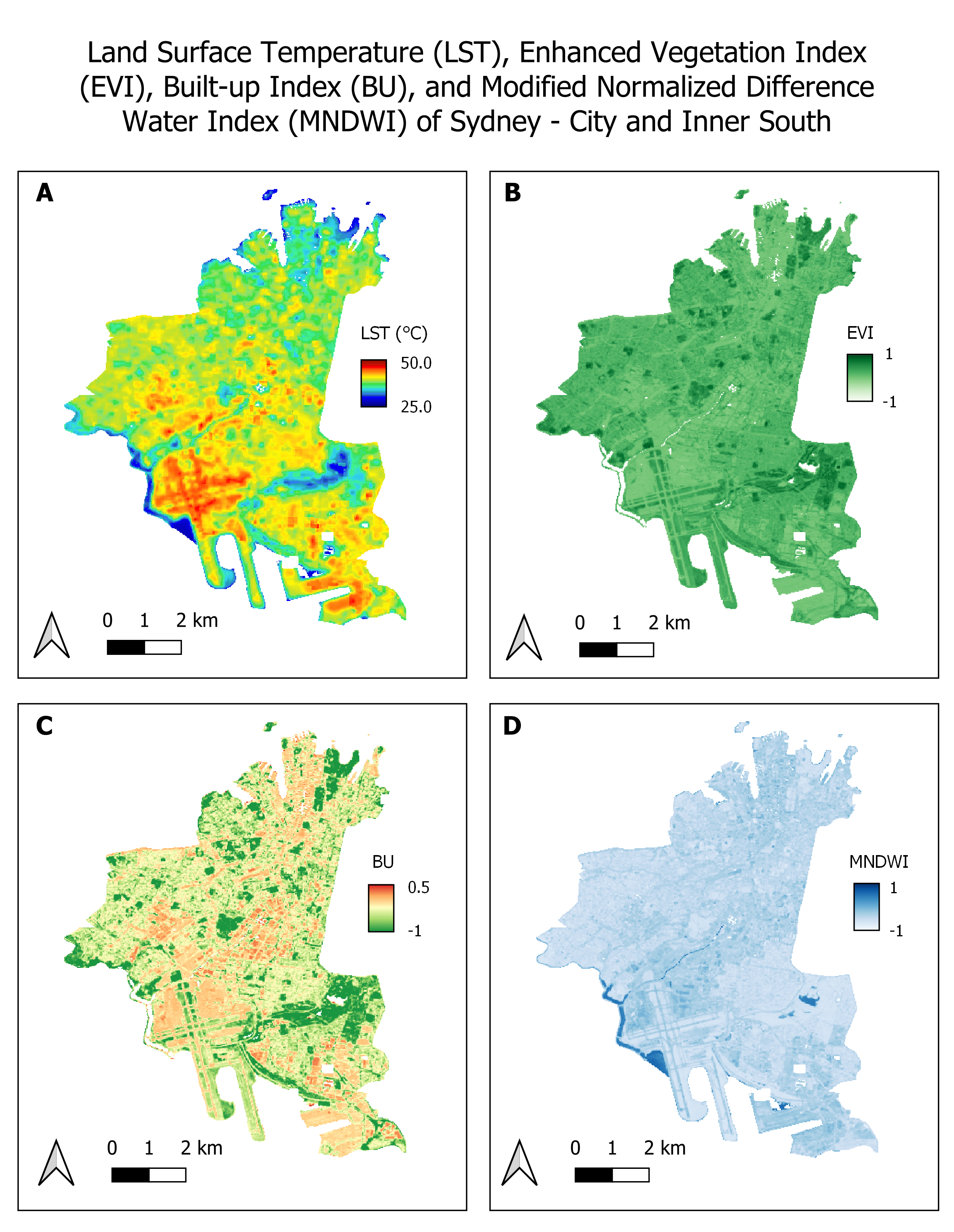
Rapid urbanization contributes to the escalating threat of urban heat islands (UHI), impacting energy consumption, public health, and exacerbating with climate change. This study employs remote sensing and GIS technologies to analyze the intricate relationship between land cover and urban land surface temperature (LST) in smaller urban areas of major Australian cities—Adelaide, Melbourne, Sydney, and Brisbane. Advanced spectral indices such as Enhanced Vegetation Index (EVI), Built-up Index (BU), and Modified Normalized Difference Water Index (MNDWI) are utilized to inform targeted strategies for mitigating UHI effects. The following report is the final assignment of GEOG3301 (Advanced GIS and Remote Sensing). Google Earth Engine was used to perform geospatial analysis and calculations.