Why is (re)development hot?: Measuring cumulative heat in Australian cities
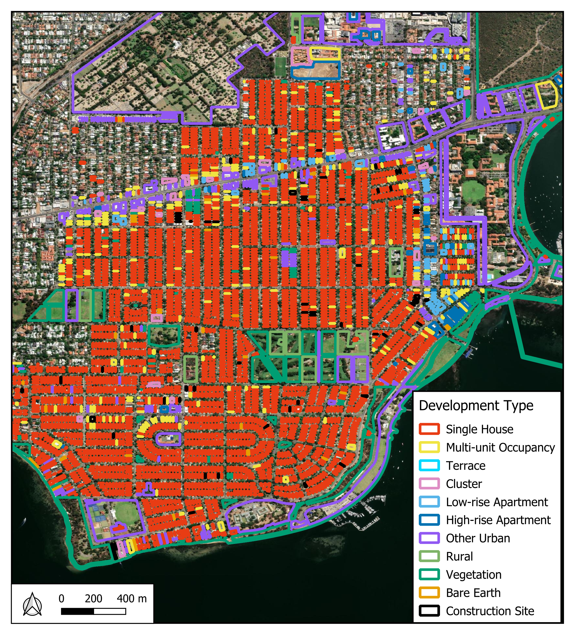
Development type classification for Nedlands-Dalkeith-Crawley area using multi-modal deep learning model
Summary: I am currently working as a research analyst at UWA's Centre for Water and Spatial Science on a 3-year project, "Why is (re)development hot?: Measuring cumulative heat in Australian cities". This project aims to investigate how different types of residential development cause urban heat across major cities in Australia.
The first part of the project involves describing how and where residential development has occured at the parcel level. We developed a deep learning model that automates the classification of development type using Nearmap AI land cover data, allowing millions of property parcels to be labelled across entire cities at multiple time points. This resulted in the first paper of our project, "Unravelling developments in residential development: automated property parcel classification and change detection using multi-modal deep learning", for which I am the primary author. The analysis from this work forms the basis for selecting development samples for further heat analysis, a key component of the ongoing research.